Real-Time Disaster Intelligence. Faster Decisions. Stronger Recovery.
Protect the people and properties that matter most with instant alerts, live maps & actionable insights
Turn Chaos Into Clarity
Earthvisionz is your all-in-one disaster intelligence platform, built to protect assets, strengthen resilience, and keep communities safe. We deliver real-time alerts, predictive maps, and verified property data so you can respond with confidence. From facility managers to insurers to restoration leaders, organizations nationwide trust Earthvisionz to save time, reduce risk, and safeguard what matters most..
Risk Management Solutions
-
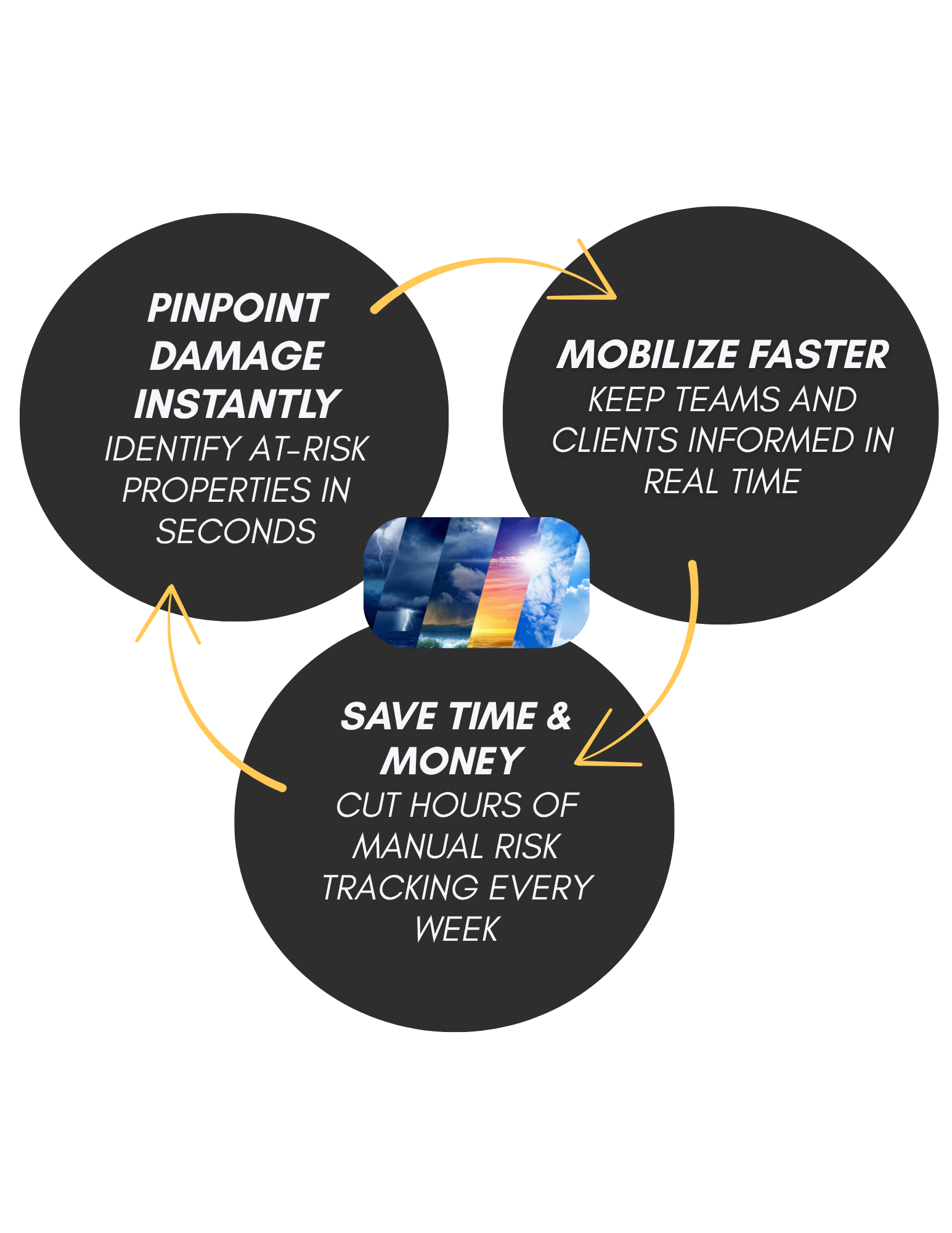
Prepare
Real-time alerts and predictive map layers help you proactively protect the assets you and your clients care about.

-
Monitor
Take action and keep stakeholders informed as the event is happening so you can plan to mobilize when it is safe to do so.

-
Recover
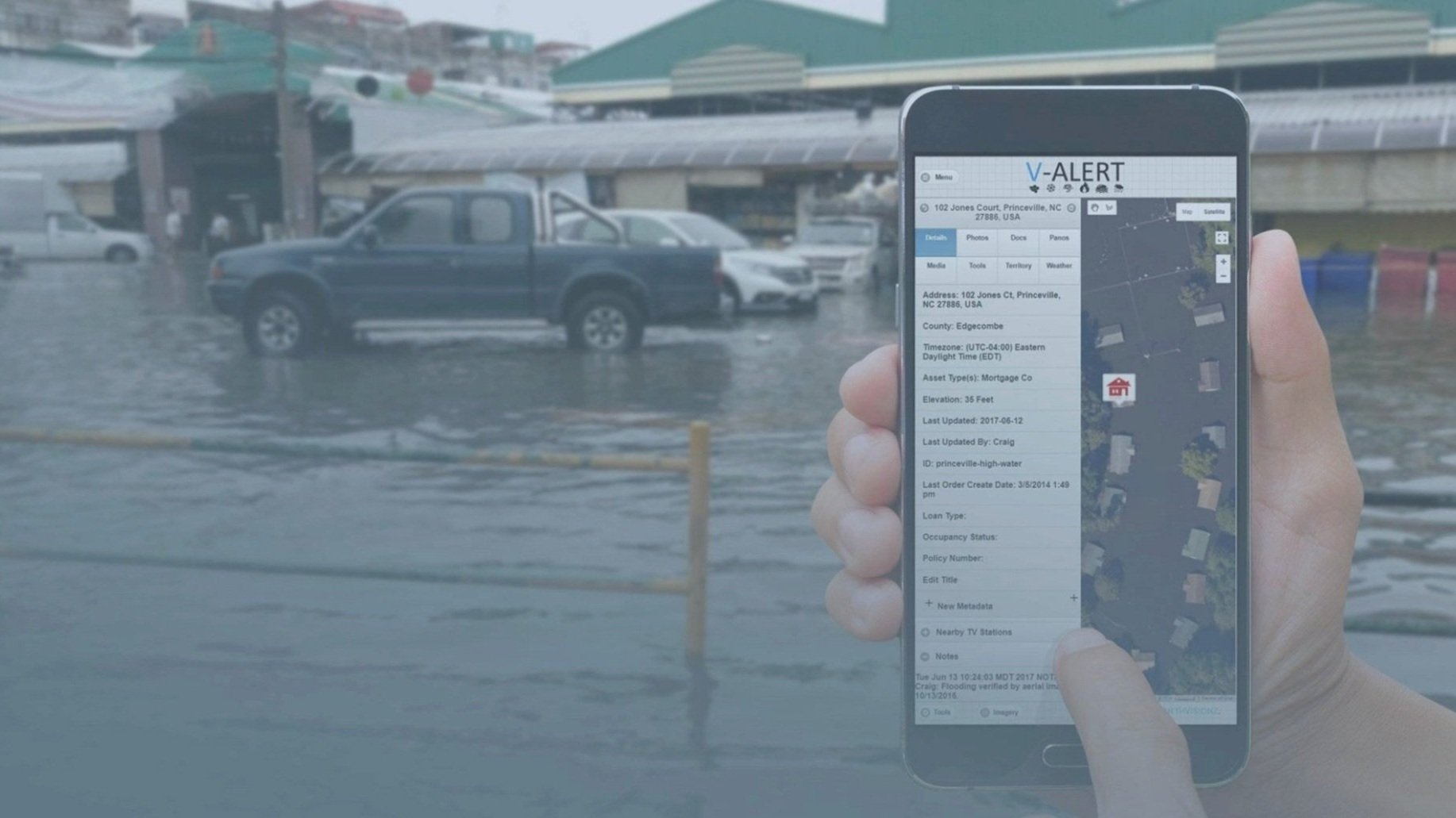
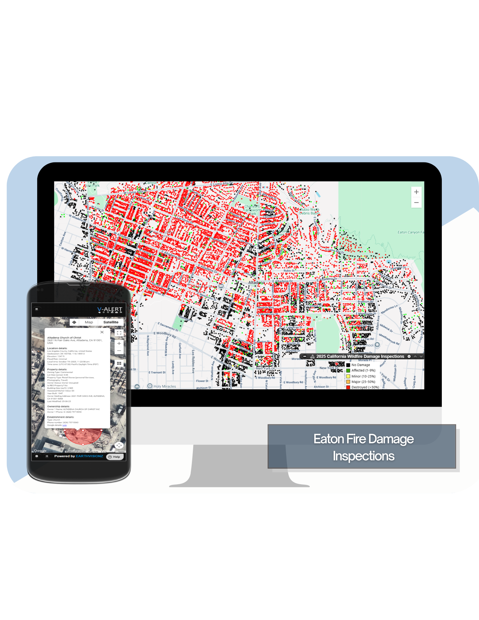
When disaster strikes, evaluate damage remotely using map layers that highlight impacted areas to prioritize and start repairs.

Why Earthvisionz?


Built for Teams That Need to Act Fast


Facilities Managers & Insurers
Risk & Ops Managers

Mortgage & Real Estate Finance
Don’t just take our word for it…
-

"$2 million worth of work.”
"My experience with Earthvisionz has been outstanding. The alerts are descriptive, timely, and comprehensive, making it easy to stay informed. Jeff and Craig have been great to work with, always responsive and attentive to my needs. Thanks to the alerts, I've secured around $2 million worth of work.”
Emergency Recovery Coordinator
Paul Davis
-

“First of its Kind”
I worked with the entire Earthvisionz team for over 6 years while I was leading digital product development efforts at the PGA Tour. We engaged with them to build out the first ever “live map” experience integrating information about fixed points of interest throughout tournament venues along with the PGA Tour’s Shotlink scoring data for tracking live player location at over 40 events. It was a first of its kind effort and the Earthvisionz team hit a home run on all fronts - design, implementation, support, and just the overall working relationship with over 2M users.
PGA Tour Director of Product Development
-

“Accurate , real-time information"
“Helping our customers prepare for potential disasters ahead of time is essential and Earthvisionz is an extremely valuable part of that process. Their alerts provide accurate, real-time information that helps us and our customers stay informed."
ServiceMaster by Cornerstone
-

“Quickly Pool Resources for Response”
Earthvisionz provides real-time weather information and communication for ATI and more importantly our clients. ATI is able to quickly pool resources for response knowing exactly what client assets may be affected while our clients can engage their disaster recovery plan to mitigate loss. The partnership created by Earthvisionz is critical to the program.”
ATI

It all starts when you map your assets.