Amplifying Hurricane Alerts with V‑Alert & Social Media in 2025
How technology and crowdsourced insights are reshaping disaster response
As we head into the heart of the 2025 hurricane season, emergency managers, restoration companies, and insurers are all asking the same question: How can we stay one step ahead of fast-moving storms? The answer lies in blending predictive sensor technology with the real-time pulse of social media.
At Earthvisionz, we’ve seen firsthand how the combination of our proprietary V‑Alert system and crowdsourced social platforms can dramatically accelerate situational awareness—giving teams the confidence to act sooner and respond smarter.
What is V‑Alert?
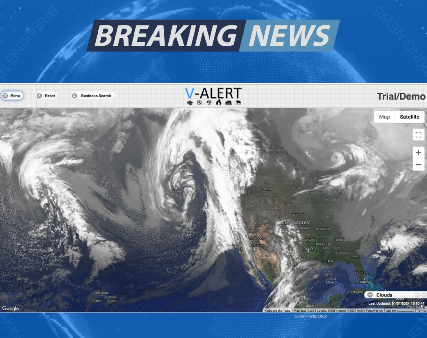
V‑Alert is Earthvisionz’s real-time monitoring system powered by live sensor feeds, satellite data, and machine-learning storm modeling. It’s designed to:
Detect wind speeds, rainfall, and surge risk early
Trigger customized alerts based on location or asset type
Integrate directly with your workflow tools or ERP system
Visualize threat levels across entire property portfolios
It’s not just an alert system—it’s a strategic advantage.
Why Social Media Still Matters in 2025
While sensor data tells us what’s happening, social media often tells us what’s happening first. Platforms like X, Instagram, and Facebook remain essential during hurricane events, surfacing:
On-the-ground video of damage before drones can fly
Crowd reports from areas where sensors are offline
Verified imagery that supports remote insurance assessments
Fast confirmation of flooded roads, blocked access routes, and downed infrastructure
When these insights are layered into Earthvisionz’s mapping dashboards, you gain a richer, faster, more human view of the storm.
Case in Point: Hurricane Francine

When Hurricane Francine made landfall last year, restoration teams using Earthvisionz had already pre-positioned equipment and staff in high-risk zones 48 hours earlier. How?
V‑Alert identified property clusters at greatest exposure
Social media signals (geo-tagged photos + user reports) validated field-level risk
Combined insights allowed restoration teams to mobilize ahead of impact, not after
The result: faster response, less confusion, and stronger client trust.
How to Integrate This into Your 2025 Response Plan
Whether you’re a property manager, insurance adjuster, or disaster response team, here’s how to put this into action:
Enable V‑Alert for your top regions and assets
Create auto-alerts tied to hurricane triggers from NOAA, V‑Alert, and NHC
Set up a real-time social media feed for relevant hashtags and locations
Use Earthvisionz mapping layers to visually combine sensor and social data
Adjust staffing and equipment deployment based on projected vs observed damage
The Bottom Line
Speed saves.
In 2025, waiting for damage to be confirmed by field visits costs precious hours—or days. Earthvisionz gives you the power of early action, blending technology with human insight so you can outpace the storm.
Need help building your hurricane playbook?
Let’s talk. Earthvisionz can help you track, alert, and respond—before the storm hits.